Imagine you land at Milan Bergamo Airport (Orio al Serio), retrieve your backpack from the conveyor belt and, instead of looking for a cab, start walking. The Valle Brembana (IVB) Itinerary turns an international stopover into your privileged gateway to the Western Orobie Mountains.
A new way of experiencing an international airport: not just a place of transit, but a gateway to a world of nature, history and high altitudes, designed for those who love to backpack and want to turn arrival into an experience.
From the terminal, you reach the bike/pedestrian path that leads into the heart of Bergamo, enter the Upper City and climb up to San Vigilio, then cross the urban boundaries and enter the green of the Parco dei Colli di Bergamo. It is here that the city fades behind and the path opens up to farmsteads, woods and rural landscapes as far as Ponteranica and Sorisole, where the mountains begin to make themselves felt.

Brembana Valley Entrance
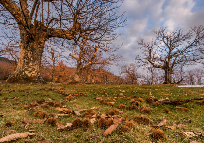
Beyond the Canto Alto massif, the descent to Zogno introduces the Brembana Valley through the striking Chestnut Street. From here we continue along the bicycle promenade which runs along the Brembo River, past tunnels and ancient stations, to San Pellegrino Terme, where the Liberty and the water landscape create a unique atmosphere. The march slows down in San Giovanni Bianco, between Oneta and the medieval village of Cornello dei Tasso, crossing from the ancient merchants' route. Once past Lenna and Piazza Brembana, the valley narrows and the route prepares to climb toward the great Orobic vistas.
The loop and the return to the valley
From Cassiglio the more alpine section begins, along the Trail 101, which leads to the Piani di Artavaggio and Bobbio Plains, the Grassi, Benigni and Calvi refuges, and to the passes of San Marco, Tartano and Dordona, among high grasslands, alpine lakes and open views of border peaks.
The itinerary touches on the Twin Lakes and descends toward Roncobello along the “Roccoli Trail”, an environment suspended between forests, rock faces and high-altitude pastures. The ancient mule tracks on the valley floor finally lead back to Piazza Brembana, closing the large loop. From here the return to Orio al Serio is simple: bus, bicycle or, for those who can't get enough, still walking.
A route for trained hikers
The overall course measures 168 km with almost 9,000 meters of positive elevation gain: a great trip for trained hikers, but decomposable into shorter stages, suitable for those who want to experience one section at a time.
A challenging walk that can be modulated into several stages and offers a new way of experiencing travel: no longer the airport as a place of transit, but as a threshold that opens to one of the most fascinating hiking experiences in the Bergamo Alps.
Here is our proposed walk in 18 stages, the first 6 available with full video of the stage: