Walking itinerary

From Bergamo (Monterosso) to Selvino

A scenic route through hills, forests and ancient villages, leading from Bergamo to the cool heights of Selvino, providing excitement at every step.

Starting point:
Via Quintino Alto, Bergamo, BG, Italy
End point:
Selvino, BG, Italy
On foot Hiking
04:30 h
14.0 km
850 m
200 m

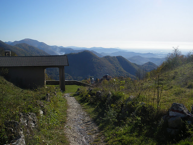
The trail starts from Via Quintini Alto in Bergamo's Monterosso district and follows a charming route to the Selvino plateau, passing through some of the most iconic places in the Bergamo hills. Near a large villa, a narrow path through the woods climbs gently up to the pretty little church of San Marco on the Maresana Hill, a popular vantage point for hikers.

Continuing along the road coming from Ponte Secco and Costa dei Garatti, you reach the Croce dei Morti and then the historic Ca’ del Làcc, where the trail crosses CAI trail No. 532. From here you continue left on a narrow but very charming trail that contours the slopes of Monte Solivo and Monte Luvrida, offering striking views of the valley below, until you reach the Forcella di Sorrisole.

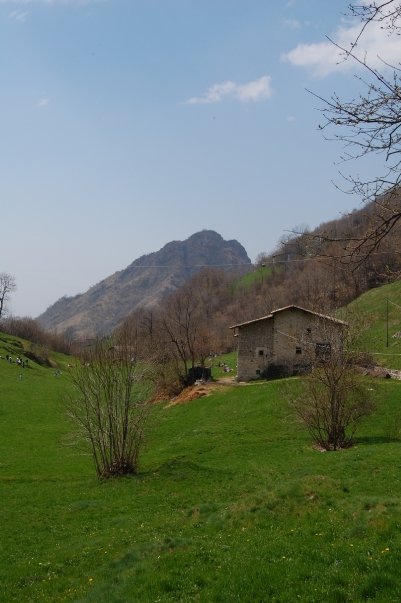
The trail continues to the right, crossing the eastern slope of Campanua Mountain, arriving at Canto Basso, a scenic crossroads in the heart of the hills. From here the route points toward Monte di Nese, where it meets CAI trail No. 531. After passing the ancient village of Castello, it advances halfway up the hillside through woods and clearings, tackling a few short steep sections until it reaches Salmezza, the junction point with trails 531 and 534.

The last stretch, on a comfortable asphalt road, finally leads to Selvino, the final destination of the hike and an ideal place for a scenic stop among nature, villages and fresh highland air.
Recommended period
JanFebTueAprmagdownJulneedlesetOctNovDec
Accessibilità  con sedia a rotelle NO
Toll road at departure NO
Other itineraries On foot
Selvino GPX ✓
San Pellegrino Terme GPX ✓
00:37 h
2.4 km
Costa Serina GPX ✓
Selvino GPX ✓
San Pellegrino Terme GPX ✓
04:00 h
4.6 km
San Pellegrino Terme GPX ✓
Lenna GPX ✓
04:20 h
13.0 km
Oneta GPX ✓
01:30 h
3.0 km
Sedrina GPX ✓
Itinerary

Tavern Road

03:30 h
5.0 km
GPX ✓
Sedrina GPX ✓
4:45 PM | 9 stages
51.0 km
Ornica
04:00 h
6.8 km
San Giovanni Bianco GPX ✓
Vedeseta
02:00 h
4.5 km
Cornalba
04:30 h
7.8 km
Oneta GPX ✓
05:30 h
12.0 km
Aviatico GPX ✓
Aviatico GPX ✓
02:15 h
5.7 km
Zogno GPX ✓
Aviatico GPX ✓
Over the Hill GPX ✓
Over the Hill
02:30 h
5.0 km
Zogno GPX ✓
01:00 h
2.0 km
San Giovanni Bianco GPX ✓
Mezzoldo GPX ✓
25.0 km
San Pellegrino Terme GPX ✓
Itinerary

Mount Zucco

02:00 h
5.3 km
San Giovanni Bianco GPX ✓
Val Brembilla GPX ✓
Branzi GPX ✓
Val Brembilla
02:45 h
10.0 km
Dossena GPX ✓
Costa Serina GPX ✓
San Giovanni Bianco GPX ✓
Selvino GPX ✓
01:30 h
2.3 km
Roncobello GPX ✓
05:00 h
7.1 km
Roncobello
San Giovanni Bianco GPX ✓
Aviatico
Val Brembilla GPX ✓
Over the Hill GPX ✓
Taleggio cheese
Val Brembilla
04:00 h
15.0 km
Piazzatorre
Selvino GPX ✓
Camerata Cornello GPX ✓
Fondra Island
00:15 h
1.0 km
San Giovanni Bianco GPX ✓
Selvino
00:40 h
1.8 km
Zogno
01:30 h
4.0 km
Branzi
01:30 h
4.0 km
San Giovanni Bianco GPX ✓
Branzi GPX ✓
02:36 h
6.0 km
Aviatico GPX ✓
02:40 h
5.3 km
Selvino GPX ✓